Deep Traffic Signs
Real-time road sign assistance
This project is maintained by octaexon
Links
Data
Before we can decide what to do, we need to get some understanding of what we have at our disposal.
Bounding the extent of the challenge
Focussing on the recognition stage for a moment, a comprehensive road sign classifier is a significant undertaking. The number of distinct signs on our roads is incredibly large and ever increasing. For example, here’s a sign we didn’t have on our roads until recently:

Evidently, I need to place restrictions to ensure feasibility.
-
descriptive The majority of signs are descriptive (e.g. direction, location etc.):
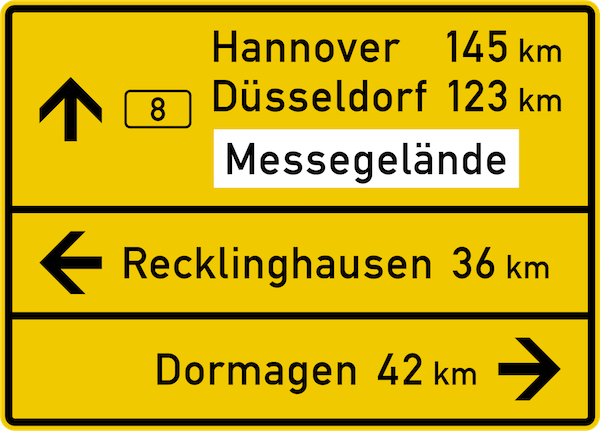
Textual comprehension is beyond the scope of this project; I will restrict to symbolic comprehension.
-
Vienna convention Road signs are standardized by the Vienna Convention on Road Signs and Signals. This is a multilateral treaty designed to increase road safety and which the majority of European countries have ratified. It categorizes signs into one of 8 groups:
warning priority prohibitory mandatory 



special informative indicative additional 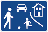


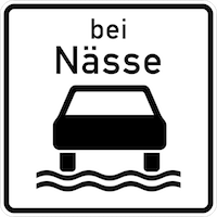
and prescribes certain characteristics: shapes, colors, sizes. Having said that, in any given country, there are certainly large numbers (>500) of distinct symbolic signs (see here for a sample of German signs and here where I located some nice pngs). Again, with an eye to future data collection, I will restrict to a very small number.
-
intraclass variety For any given sign, there are very often national differences in the precise realization of signs, even among those countries signed up to the Vienna convention. For example, a quick look at Wikipedia yields the following:






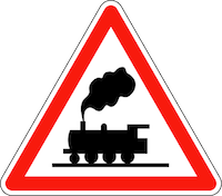
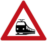


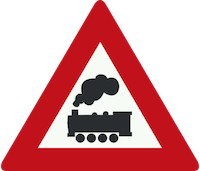




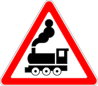
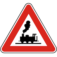
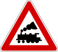




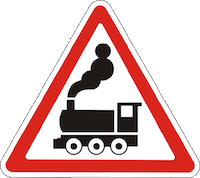

However, my data sources are unlikely to be so diverse. I’m based in Berlin, so any manual data collection will be local and as I’ll discuss below, my core dataset is sourced in Germany, so I should expect a classifier that deteriorates in performance outside of Germany. This is really not a concern for my project, as my live testing will also occur here.
GTSDB
As I stated earlier, the core dataset comes from the GTSDB (German Traffic Sign Detection Benchmark). This link downloads the associated zip file and on the surface, it’s a relatively meaty 1.6GB. Unfortunately, the files are in the rather inefficient Portable Pixmap format (24-bit-color images where each pixel is encoded as uncompressed text). On closer inspection, there are only 900 images spread across 43 classes. Here is their distribution:
As its name suggests, this is a benchmarking dataset, so one course of action, would be to compare any model I construct against the benchmark. However, I’m not motivated to go down that road and you can see why if you look inside the dataset: even within the more frequently occurring classes, the environment is not particularly diverse. Of course, road signs occur at roads, so one shouldn’t expect a magical wonderland of diversity, but:
-
weather Typically German, mostly cloudy with some sunny scenes. However, adverse conditions: rainy, sleety, stormy, snowy are underrepresented (some do not occur at all).
-
illumination All are taken during the day, sunrise and sunset are underrepresented and nighttime scenes are completely absent.
-
line of sight While there are examples of signs falling in varying degrees of shadow and some with moderate blur, no occlusion occurs.
Certainly, some of the signs are difficult to read so models doing better on this benchmark are probably better in real life, but the benchmarking error rates are unlikely to hold any precise meaning for real world applications.
Given the constraints detailed earlier, I find it more interesting (and indeed more feasible) to develop a model restricted to a very small number of signs and attempt to evaluate on live test data in a variety of conditions.
Statement of intent
I picked the following signs:
| priority road | give way | speed limit 30 | speed limit 50 |
|---|---|---|---|
 |
 |
 |
 |
for the several reasons:
-
frequency They are among the most frequent in the GTSDB dataset. Moreover, I live within city limits, and generally 50km/h is the default speed limit within a German city, with 30km/h for smaller streets. Since it is a small dataset a major consideration is the ability to collect more data.
-
interclass variation It tests two criteria: that the model can pick out various shapes and colors (admittedly, this should be easily satisfied within the relatively high capacity models that I’m going to consider) and that it can pick out subtler differences (the speed limit signs differ only in the text).
With preliminary data at hand, let’s pick out the models.